-
Title
-
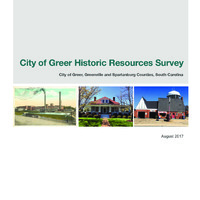
City of Greer Historic Resources Survey
-
Description
-
An architectural resources survey of the City of Greer, South Carolina for the Planning and Zoning division of the Building and Development Standards Department and the South Carolina Department of Archives and History (SCDAH). The objective of this survey was to add to the inventory of recorded historic architectural resources within the City limits (survey area) that retain sufficient integrity to be included in the South Carolina Statewide Survey of Historic Properties (SSHP) and to identify those properties and districts that are eligible for listing in the National Register of Historic Places (NRHP).
-
Creator
-
Brockington and Associates, Inc.
-
Publisher
-
Brockington and Associates, Inc.
-
Coverage
-
City of Greer, Greenville and Spartanburg Counties, South Carolina
-
Date
-
2017
-
Format
-
PDF
-
Accession Number
-
2021.1.1
-
Accession Date
-
September 8, 2021
-
Accession Creator
-
David Lovegrove
-
list of authors
-
Sheldon Owens, Historian/Project Manager
Charlie Philips, Historian
-
number of pages
-
119
-
Curatorial Information
-
This document is a serious historical investigation and is a great asset to the record of Greer. We have identified some erroneous information, each of which is simply repeating errors published by prior sources. Errors noted include:
— Page 16 states, "The most important railroad development in the post-Civil War Period in Greenville and Spartanburg Counties was the construction of the Atlanta and Charlotte Air Line Railway (A&CAL)." In reality, the A&CAL did not exist until 1877. That original line was constructed by the Atlanta & Richmond Air-Line Railway (A&RAL), a wholly-owned subsidiary of the Richmond and Danville Railway. The first trains that rolled through Greer would have been A&CAL. This error has been made in many sources, and it's understandable: the railroad history is very complex.
— On page 21, Figure 2.7 is incorrectly labeled "Main Street." It is actually a photograph of Trade Street from the corner of Randall Street, looking north. Since the photograph is incorrectly labeled, the document makes the incorrect inference (on page 20) that all of these buildings were later removed from Main, since none of them still exist there. Given the citation, it seems that the incorrect inference was first made in the National Historic Places Nomination documents.
